Mission
![]()
SMOS Mission
The Soil Moisture and Ocean Salinity (SMOS) Mission implements the 2nd Earth Explorer Opportunity Mission led by ESA. The primary objective of the SMOS mission is the global observation of soil moisture and ocean salinity, two important parameters needed for accurate modelling of weather and climate. These variables are measured by the SMOS instrument (a microwave imaging radiometer with aperture synthesis) through the brightness temperature at L-band.
The SMOS payload is an L-band (21 cm, 1.4 GHz) 2D interferometric radiometer on a generic Proteus platform.
The mission lifetime is at least 3 years (0.5 for commissioning and 2.5 for normal operation) + 2 years (extended operation) + 10 years for post-mission processing.
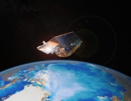
The satellite was launched on 2 November 2009. SMOS was launched on a sun-synchronous (06:00 am ascending) circular orbit at 755 km altitude. The revisit is 3 days.
Raw physical data, level 1 and level 2 products are produced by the PDPC (SMOS Payload Data and Processing Centre). It is an ESA centre located in Villafranca (Spain) and operated under the responsibility of ESA.
The SMOS Soil Moisture objective is an accuracy of 4% on volumetric soil moisture, with three days revisit and a spatial sampling better than 50 km.
The SMOS Ocean Salinity objective is an accuracy better than 0.1 PSU, with a 10-day to monthly grid scale (200 km). Knowing that single measurement will be less accurate (~1 PSU), spatial and temporal averages will be needed to reduce the noise.
Scientific Objectives
The main objective of the SMOS mission is to deliver crucial variables of the land surfaces—soil moisture—and of ocean surfaces—sea surface salinity fields. The mission should also deliver information on root zone soil moisture, vegetation, and biomass, and lead to significant research in the field of the cryosphere.
Over the Land
Water and energy fluxes at the surface/atmosphere interface are strongly dependent upon Soil Moisture. Evaporation, infiltration and runoff are driven by moisture while soil moisture in the vadose zone governs the rate of water uptake by vegetation. Soil moisture is thus a key variable in the hydrologic cycle. Soil moisture and its space-time evolution are important variables for numerical weather and climate models, and should be accounted for in hydrology and vegetation monitoring.
For the Oceans
Sea Surface Salinity plays an important role in the Northern Atlantic sub polar area, where intrusions with a low salinity influence the deep thermohaline circulation and the meridional heat transport. Variations in salinity also influence the near-surface dynamics of tropical oceans, where rainfall modifies the buoyancy of the surface layer and the tropical ocean-atmosphere heat fluxes. Salinity fields and their seasonal and inter-annual variabilities are thus tracers and constraints on the water cycle and on the coupled ocean-atmosphere models.
Even though both moisture and salinity are used in predictive atmospheric, oceanographic, and hydrologic models, no capability exists to date to measure directly and globally these key variables. SMOS is aimed at filling this gap through the implementation of a mission that has the potential to provide globally, frequently, and routinely this information. It is also expected that the SMOS mission will provide significant information on vegetation water content, which will be very useful for regional estimates of crop production.
Finally, significant research progress is expected over the cryosphere, through improving the assessment of the snow mantle, and of the multi-layered ice structure. These quantities are of significant importance to the global change issue. Research on sea ice will also be carried out.